Summary
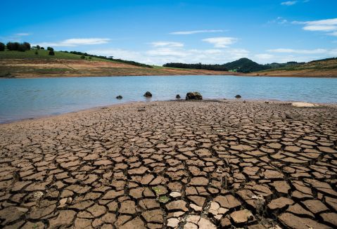
GlobeDrought aims to develop a web-based information system for comprehensively characterising drought events. The project will produce a spatially explicit description of drought risks by considering three components: drought hazard, exposure and vulnerability. It will investigate how droughts impact water resources, crop productivity, trade in food products and the need for international food aid. In terms of methodology, the project aims to link satellite-based remote sensing and analyses of precipitation data with hydrological modelling and yield modelling. This will produce indicators for characterising meteorological, hydrological and agricultural droughts, which in turn will make it possible to quantify drought risks. Analyses of socioeconomic data will provide the basis for quantifying exposure and vulnerability. Within the framework of a co-design process, users and stakeholders will help to shape the content and technical design of the drought information system. The global-scale analyses planned for the project will be supplemented by detailed analyses for regions heavily affected by droughts, in particular Southern Africa.
Priorities
- Analyse past drought events and establish drought risks on a global scale
- Perform a detailed analysis of drought events and drought risks for selected regions
- Analyse the impact of droughts on selected regions and on trade flows in food products
- Develop and test an integrated drought information system
Relevance
In times of drought, water resources are insufficient. These water shortages often have negative effects on agricultural productivity and on associated socioeconomic factors. They can cause reduced income, food shortages and even famines. Operational early warning systems for droughts try to address the problem. However, they are mostly only capable of characterising the status quo, or offer limited forecasts for droughts in the near future – e.g., the next three to six months. These early warning systems generally do not sufficiently integrate variables and drought indicators. In particular, they do not adequately describe causal links in the formation and development of droughts, connections between the various types of droughts (meteorological, hydrological and agricultural), and socioeconomic factors. The project intends to fill this gap by developing an integrated drought information system, With its planned experimental early warning system, the project aims to reduce the time between satellite-based data collection, identification of a drought risk and the implementation of countermeasures by political decision-makers and those involved in international humanitarian aid.
 uni-goettingen.de
